


Highlights of the Superior Hiking Trail app for iPhone and iPad
Developer: Out There Software LLC
First release : 15 Oct 2011
App size: 10.52 Mb
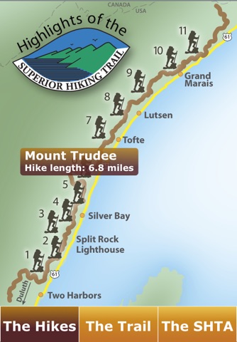
Your guide to unforgettable hikes that include waterfalls, river gorges, and spectacular overlooks of Lake Superior and inland forests. These are eleven of the Superior Hiking Trail Association favorites, ranging in length from 2 to eight miles. The Superior Hiking Trail is located along the scenic North Shore of Lake Superior in northeastern Minnesota.
Highlights of the Superior Hiking Trail includes:
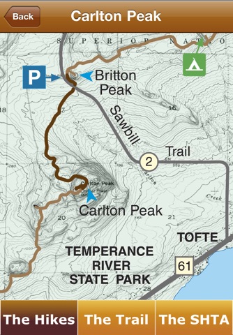
- descriptions of each hike
- a trail map for each hike
- directions to the starting points
- all trail maps are included in the download
Superior Hiking Trail Highlights:
- extends over 280 miles from Duluth, Minnesota to the Canadian border
- designed for both day hikes and backpacking
- passes through both public and private lands
- easily accessible every few miles
- signs at the access points
- trail is well marked with blue paint blazes along the trail
Hike safely!
- wear sturdy footwear
- carry water and snacks
- bring rain gear
- allow one hour for every one to two miles walked
Dogs are allowed on leash only. No off-road vehicles or bicycles allowed. Camp only in designated sites.
The Superior Hiking Trail Association builds, maintains, and manages the trail with the help of hundreds of members and volunteers.